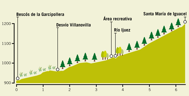
Trail 6: Garcipollera valley
The route proposed starts in Bescós de la Garcipollera, and climb up along the rigth bank of the River Ijuez, first along a paved road which soon becomes a dirt track taking us to the aabandoned, rundown village of Acín. In the nineteen-fifties the whole region was expropiated and the hills were reforested by the State in an attempt to control the erosion that threatened the Yesa reservoir.
There is brush growing alongside the river and numerous meadows with hedgerows arount then, all surrounded by these new pine forests. In thes area it is possible to see Chaffinch, Crested Tit, Eurasian Wryneck, Tawny Owl, Grey Wagtail, Wren, Green Woodpecker, Booted Eagle, Golden Oriole, Coal Tit, Long-tailed Tit, Eurasian Sparrowhawk, Eurasian Jay and Red Kite.
The trail fords the river and then continues slowly upwards along the left bank surrounded by pine trees until it reaches the church of Santa Maria de Iguacel. Here we find Common Crossbill, Common Buzzard, Great Spotted Woodpecker, Great Tir and if we climb up a bit higher, Alpine Pipit, Northern Wheatear and Grey Partridge.
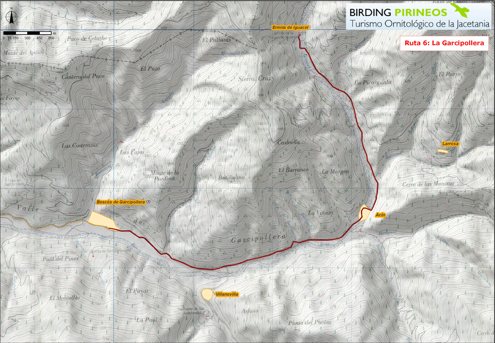
Click on the path to see the trail; you can use the buttons + / - to zoom on the map. Certified accomodations are marked with their color type (excellent, high, medium and basic).