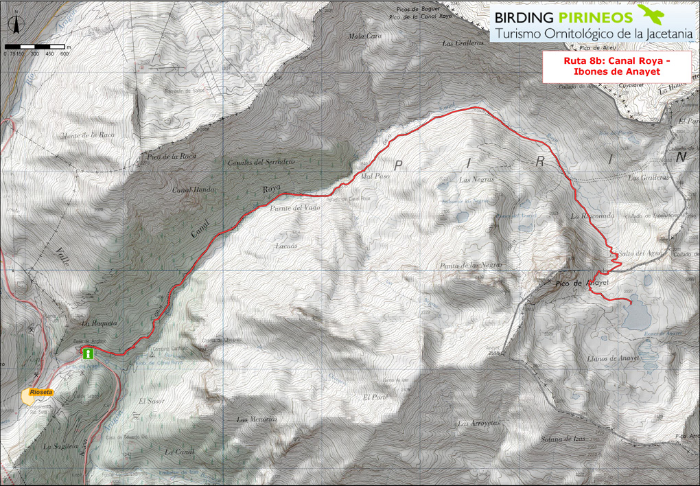
Trail 8b: Somport – Canal Roya and Anayet
The route proposed leaves the carpark at the entrance to Canal Roya at an altitude of 1400 metres. The road crosses a bridge over the River Aragón and takes us into Scots pine forest until we come to the spring known as Fuente del Cerezo. As the trail climbs, the forest gradually gives way to scrub and grassland. This is a good place to see Yellowhammer, Red-backed Shrike, Common Bullfinch, Grey Partridge and Dipper.
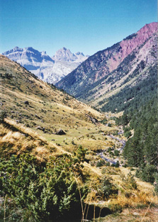
The trail crosses over the ravine via the Vado bridge, and reaches the Lacuart refuge as it comes out into large meadows used for casttle-grazing. The sandstone cliffs all around us have a characteristic red appearence, know as ‘royo’, which lends its name to this spectacular beauty spot of glacial origin.
Surrounded by mountain pastures, reddish slopes and cliffs, we reach the base of the Rinconada, a glacial corrie located at an altitude of almost 1900 metres, wwith the peak of Anayet on our right, forming the division between the valleys of the rivers Gállego and Aragón. The walls of the cirque can be ascended via the path whitch loops its way steeply up the mountainside and take us to the upper level with the tarns and peatlands of Anayet. This highland landscape affords us the opportunity to see Snowfinch, Lammergeier, Alpine Pipit, Common Crow, Alpine Accentor, Yelow-billed Chough, Wallcreeper, Rock Ptarmigan and Rock Thrush.
Click on the path to see the trail; you can use the buttons + / - to zoom on the map. Certified accomodations are marked with their color type (excellent, high, medium and basic).